
The Western Alaska Salmon Stock Identification Program (WASSIP)
Area Maps
Area Maps
| Map | Description |
|---|---|
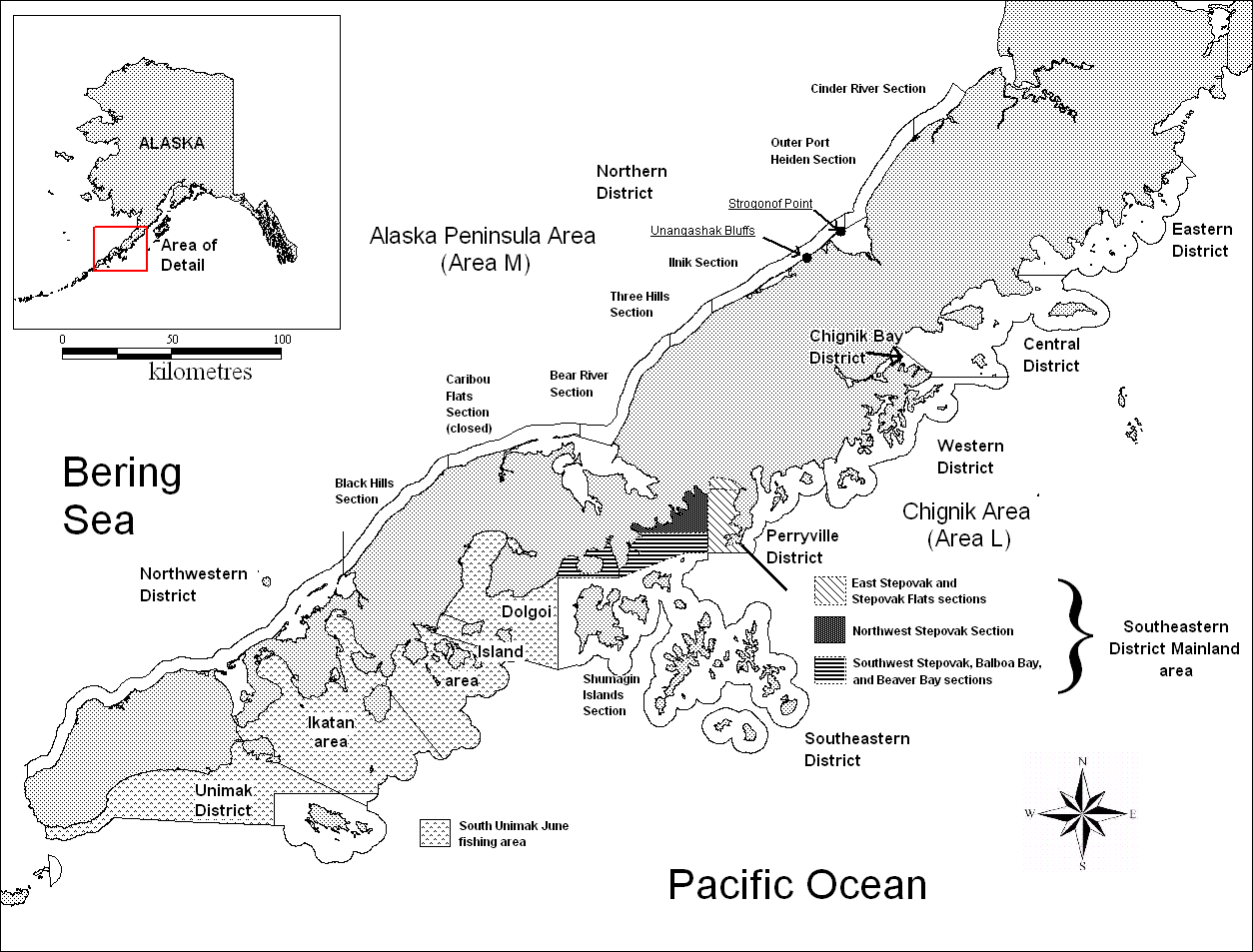 |
Figure 1. — Chignik Area (Area L) and Alaska Peninsula Area (Area M) map depicting commercial fishing districts where fishery harvests were sampled for WASSIP. |
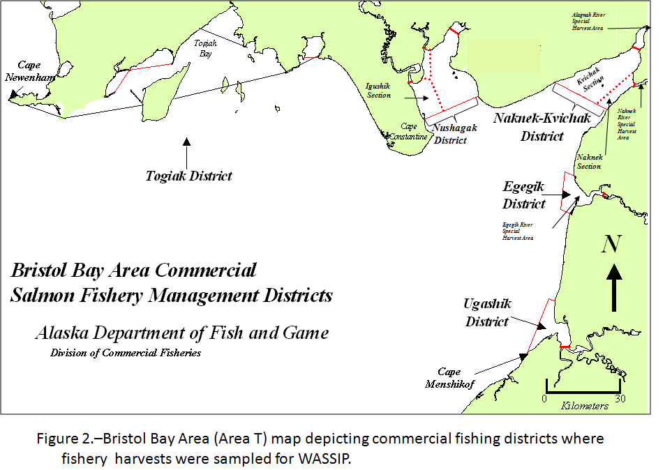 |
Figure 2. — Bristol Bay Area (Area T) map depicting commercial fishing districts where fishery harvests were sampled for WASSIP. |
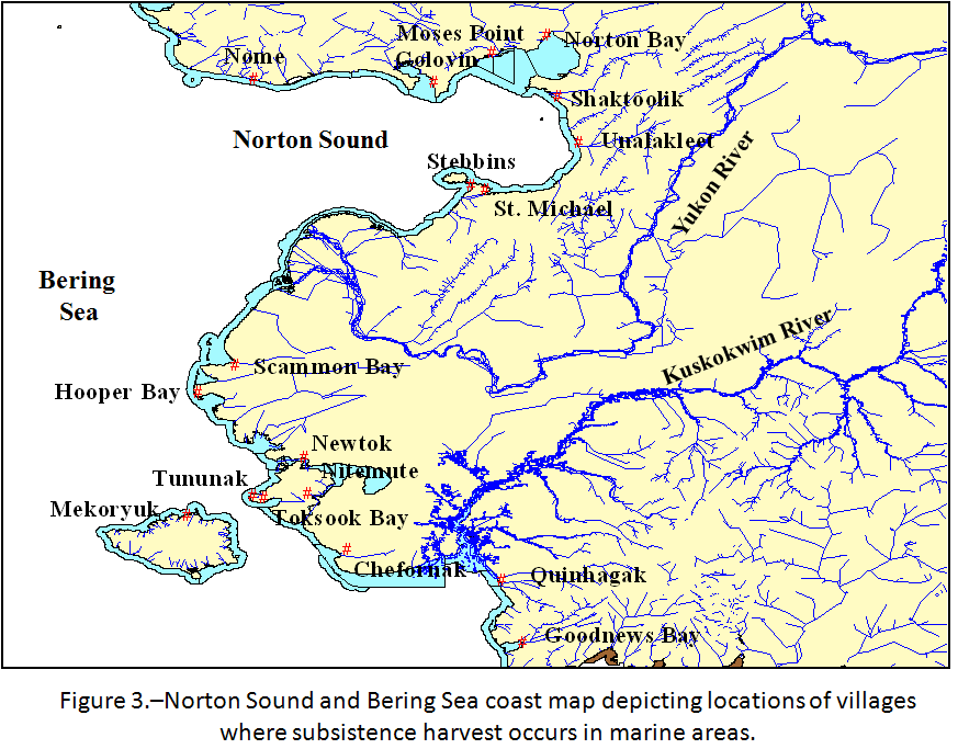 |
Figure 3. — Norton Sound and Bering Sea coast map depicting locations of villages where subsistence harvest occurs in marine areas. |
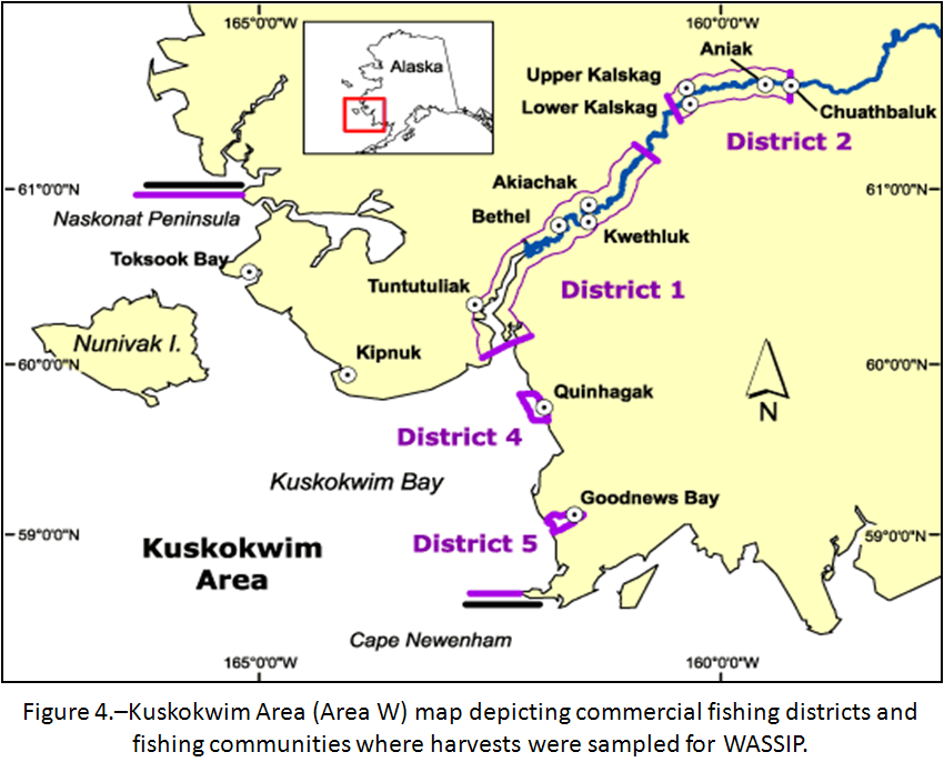 |
Figure 4. — Kuskokwim Area (Area W) map depicting commercial fishing districts and fishing communities where harvests were sampled for WASSIP. |
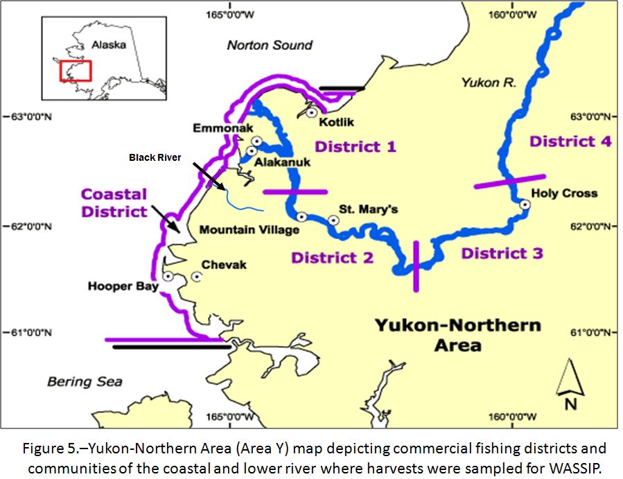 |
Figure 5. — Yukon-Northern Area (Area Y) map depicting commercial fishing districts and communities of the coastal and lower river where harvests were sampled for WASSIP. |
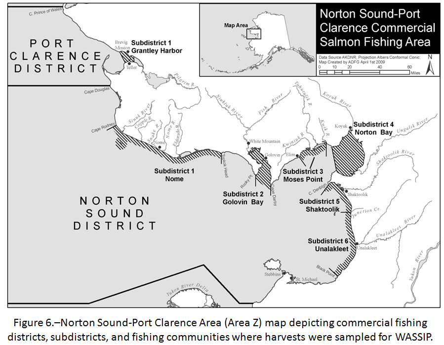 |
Figure 6. — Norton Sound-Port Clarence Area (Area Z) map depicting commercial fishing districts, subdistricts, and fishing communities where harvests were sampled for WASSIP. |
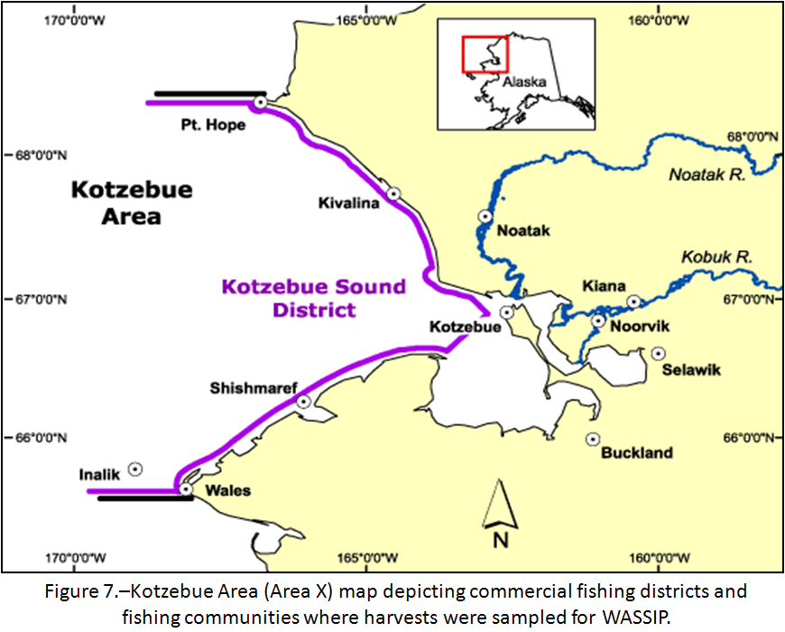 |
Figure 7. — Kotzebue Area (Area X) map depicting commercial fishing districts and fishing communities where harvests were sampled for WASSIP. |